📊 Full opportunity report: The Eye Over the City: How Wide-Area Motion Imagery Works — and Where It Goes Blind on ThorstenMeyerAI.com — validation score, market gap, and execution plan.
TL;DR
Wide-Area Motion Imagery (WAMI) allows surveillance systems to monitor entire cities in real time, capturing and archiving movement data. This technology, combined with AI, is transforming security and military operations but faces physical and technical limits.
Wide-Area Motion Imagery (WAMI) is revolutionizing urban surveillance by enabling a single sensor to monitor entire cityscapes in real time, capturing every movement across several square kilometers. This technology is now increasingly deployed in military, border security, and civilian applications, providing a persistent, archive-able record of activity that analysts can review long after the event.
WAMI systems utilize an array of cameras stitched into a gigapixel image, capable of resolving objects as small as six inches from altitudes around 17,500 feet. The images are stabilized and processed through sophisticated algorithms that detect, track, and archive moving objects, such as vehicles and pedestrians. The DARPA ARGUS-IS system, for example, uses 368 cameras to produce high-resolution images suitable for forensic analysis, making it a powerful tool for identifying and following suspects or threats.
Operationally, WAMI is installed on various platforms, including manned aircraft, drones, and tethered balloons, allowing for flexible deployment. Its primary use cases include military intelligence, border security, wildfire mapping, and disaster response, where broad coverage and detailed tracking are critical. However, the system’s reliance on optical sensors makes it vulnerable to weather conditions like fog, smoke, and darkness, which can impair image quality.
To address these limitations, WAMI is often paired with synthetic aperture radar (SAR), which can see through weather obstructions and operate in all conditions. This combination, known as layered sensing, enhances overall situational awareness, with optical WAMI providing fine-grained motion details and SAR offering deep-denied, all-weather coverage.
The eye over the city: how Wide-Area Motion Imagery works — and where it goes blind
A normal drone sees through a soda straw. WAMI watches an entire city at once, tracks every mover, and records it all for forensic rewind. Immense reach — with hard limits that make radar and AI its necessary partners.
- City-scale motion, fine detail
- Forensic rewind
- Cloud / smoke / dark degrade it
- Needs a platform loitering overhead
sensing
+ AI
- Sees through cloud & total dark
- Tasked over denied airspace
- Persistent, wide-area from orbit
- Sovereign · on-prem · air-gap
The same archive that traces a bomber to a safe house can trace anyone home — retroactively, without prior suspicion. Baltimore’s secret 2016 deployment led to a 2021 federal ruling that persistent aerial tracking violated the Fourth Amendment. The security value is real; so is the mass-surveillance risk. Who owns the sensor, the archive, and the AI is the accountability question.
WAMI’s power is the archive and the AI reading it; its weakness is weather, airspace, and oversight. The mature posture isn’t optical-vs-radar or capability-vs-liberty — it’s layered sensing (optical WAMI + all-weather SAR), AI-enabled exploitation, and sovereign, auditable control of the whole chain. WAMI shows what a persistent eye can do with clear skies and owned airspace; for the cloud, the night, and the denied area, the radar layer is where the resilient coverage lives.
Impacts of WAMI on Urban Security and Military Operations
The ability of WAMI to continuously monitor large areas and archive activity makes it a transformative tool for security, military, and emergency response efforts. Its forensic capabilities enable investigators to trace the origins of threats, track suspects across urban environments, and improve situational awareness in real time. As AI integration advances, the system’s efficiency in processing vast data streams will further enhance its utility, raising important questions about privacy, governance, and oversight.
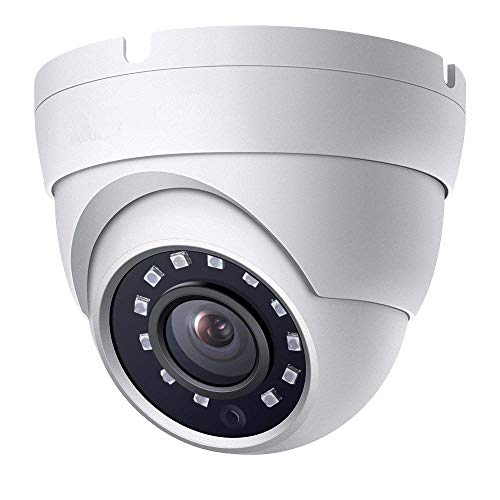
Real HD 2MP Dome TVI AHD CCTV Surveillance Security Camera, 2.8mm 100° Wide Viewing Angle, 1080P Dome Camera, 65ft Night Vision, Outdoor, Compatible with Analog TVI AHD CVI DVR, Full Metal Housing
- High-Definition 2MP Camera: 1080p resolution with 65ft IR night vision
- Wide Viewing Angle: 100° field of view with 2.8mm lens
- Multiple Resolution Support: Supports 1080P HD-TVI, CVI, AHD, 960H
As an affiliate, we earn on qualifying purchases.
As an affiliate, we earn on qualifying purchases.
Evolution and Deployment of Wide-Area Motion Imagery Systems
WAMI technology originated in early 2000s research at Lawrence Livermore National Laboratory, progressing through programs like Sonoma and Constant Hawk, and later evolving into systems like DARPA’s ARGUS-IS and the Gorgon Stare pods deployed on Reaper drones. Over two decades, WAMI has transitioned from experimental projects to widespread deployment across military and civilian domains, driven by advancements in sensor miniaturization, processing power, and AI.
Its applications have expanded beyond battlefield surveillance to include wildfire mapping, disaster response, and border security. Despite its success, WAMI remains limited by its optical nature and the need for loitering platforms, prompting ongoing development of complementary sensors like SAR to fill these gaps.
“WAMI’s combination of wide coverage and archival detail makes it a game-changer for urban security, but its effectiveness depends heavily on AI-driven automation and integration with other sensors.”
— Thorsten Meyer, AI surveillance expert

ZOSI 3K Lite Security Camera System Indoor Outdoor,AI Human/Vehicle Detection,Night Vision,Remote Access,4pcs 1080P 1920TVL Weatherproof Surveillance Cameras,H.265+ 8CH 5MP Lite CCTV DVR(NO HDD)
- High-Quality 8CH DVR: Supports 3K Lite resolution and weatherproof cameras
- Indoor/Outdoor Cameras: Sturdy, rust-resistant ABS construction with night vision
- Infrared Night Vision: Up to 80 feet in darkness with 24 IR LEDs
As an affiliate, we earn on qualifying purchases.
As an affiliate, we earn on qualifying purchases.
Current Limitations and Challenges Facing WAMI
While WAMI’s capabilities are impressive, its reliance on optical sensors makes it vulnerable to weather conditions like fog, smoke, and darkness. Although thermal infrared can mitigate some issues at night, weather remains a significant obstacle. Additionally, the high data rates and bandwidth requirements limit real-time monitoring, necessitating advanced AI for automation. The integration of SAR sensors is ongoing but not yet universally deployed, and questions remain about governance, privacy, and oversight of persistent surveillance systems.
drone-based wide-area motion imagery
As an affiliate, we earn on qualifying purchases.
As an affiliate, we earn on qualifying purchases.
Future Developments and Integration of WAMI Technologies
Advancements are expected in sensor miniaturization, AI-driven automation, and sensor fusion with SAR to overcome current limitations. Efforts are underway to develop more cost-effective, portable WAMI systems for tactical use, and to enhance data processing pipelines for faster, more accurate analysis. Regulatory frameworks and oversight mechanisms are also likely to evolve as these technologies become more widespread, addressing privacy concerns and establishing legal boundaries for surveillance.

HXVIEW 4K Solar Security Cameras Wireless Outdoor, Add-on Cam, BU-K8
- Compatibility: Add-on camera for HxviewBase system
- Video Resolution: Crisp 4K Ultra HD footage
- Night Vision: Full-color or infrared night mode
As an affiliate, we earn on qualifying purchases.
As an affiliate, we earn on qualifying purchases.
Key Questions
How does WAMI differ from traditional surveillance cameras?
WAMI covers a much larger area in a single frame, providing continuous, city-wide monitoring, unlike traditional cameras which focus on narrow, fixed points.
What are the main limitations of WAMI?
Its optical sensors are affected by weather and darkness, it requires loitering platforms which can be contested or denied, and it generates enormous data that needs AI for analysis.
How is AI used in WAMI systems?
AI automates detection, tracking, and archiving of moving objects, enabling analysts to quickly review footage and identify patterns or threats.
Will WAMI replace other surveillance methods?
No, it complements radar and full-motion video, filling specific gaps in coverage and detail, but does not fully replace them.
What are the privacy concerns associated with WAMI?
Persistent, city-wide monitoring raises privacy issues, especially regarding the collection and storage of civilian movement data, prompting calls for regulation and oversight.
Source: ThorstenMeyerAI.com